Ecosystem Field Guide
for community outreach
See who's doing what, where, and how in your community
A living, searchable directory built for community outreach — who's doing it, where, in which languages, and with whom. Populated and kept current by the organizations themselves.
Whom it's for
Ecosystem Field Guide helps funders, government agencies, coalition groups, and other community-based organizations easily search for and compare outreach partners by location, populations served, outreach languages, and activities — from a bird's-eye view.
How to use it
Whether it's to ensure our most marginalized community members are counted in the census, don't lose public benefits, are included in basic income pilots, or participate in civic engagement, use Ecosystem Field Guide to align resources and design comprehensive, multilingual, and culturally competent funding and outreach strategies.
Find trusted messengers with the language capabilities, cultural competencies, and outreach methods that meet our diverse communities where they are.
A few examples:
- A Get Out the Count initiative tracking real-time self-response rates during the decennial census wants to open a Questionnaire Assistance Center at a nonprofit serving specific low-responding census tracts.
- A funder needs organizations that can quickly canvass limited English-speaking Asian American and MENA communities in a specific city to counter election misinformation.
- A community-based organization expanding services to Farsi speakers wants a local Farsi-specialized partner to review translated forms and flyers for cultural fit.
- A funder aiming to double its funding for underserved populations by 2030 wants a real-time view of the organizational landscape to compare against its current grantees.
- A city launching an initiative for families with children under 5 wants outreach partners beyond the traditional 501(c)(3) network.
- A legislator planning a listening tour wants to see who does what, where, and how, so they can meet with a diverse group of organizations.
- A county launching a guaranteed basic income program for unhoused LGBTQ+ youth needs implementation champions who serve this population in every city.
Why it matters
For many nonprofit ecosystems, answering the basic question of who can do a certain outreach activity, in a certain language, to reach a certain population, in a certain city, is not a simple task.
But that answer determines what strategies we coordinate, which partners we collaborate with, and how we can best align resources to create the most collective impact. No organization does its work in a vacuum, so understanding the landscape and partnership opportunities at the ecosystem level is critical to the equitable distribution of resources across our diverse communities.
What it includes
- Outreach map: a heat map showing the number of organizations listed by city
- Outreach directory of nonprofits and other community-based organizations, searchable by organization, city, cultural competency, outreach language, population demographics, and outreach activities
- Listings for community-based organizations whether or not they hold 501(c)(3) status
- Additional geographic filters, including census tracts, block groups, and congressional districts, available in new deployments
- Easy three-minute data collection tool for community-based organizations
- Downloadable spreadsheet for community access to real-time data
- Because the directory is self-reported, we recommend every deployment have someone lightly steward accuracy over time — a role we can help you design.
What it looks like
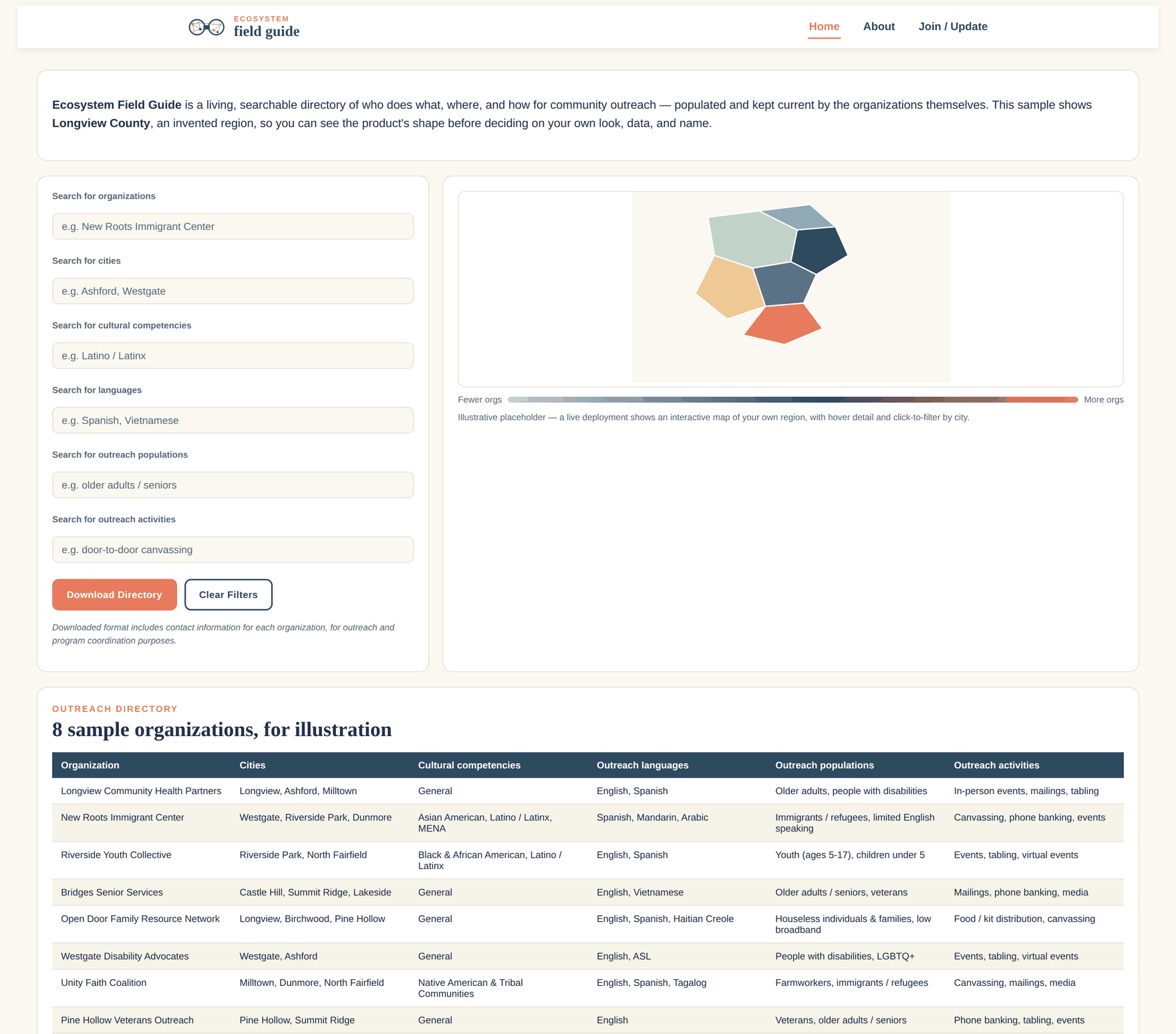
See it in action: Map My CBO, Orange County
Ecosystem Field Guide's first deployment is Map My CBO, live today across Orange County, California — built in partnership with Charitable Ventures, with support from the Orange County Community Foundation and OC Grantmakers.
Every regional deployment gets its own name, chosen with the local partners who help bring it to their community — Map My CBO is Orange County's. The tool underneath is the same Ecosystem Field Guide platform.
Today it tracks 220+ organizations across 24 languages, updated by the organizations themselves.
Built by people who use it.
 good work collaborative
Ecosystem Field Guide grew out of a real need. During the 2020 Census, we tracked self-response rates in real time and issued rapid-response grants to the neighborhoods falling behind — but we were coordinating 150+ organizations across a seven-county, $3.7M campaign with no simple way to see who was doing what, where, and in which languages.
This is the tool we wished we'd had then: a living, searchable directory that would have told us exactly which partners to call when a specific census tract needed help.
No log-ins, technical data skills, or mapping software required. Just the exact information we need and nothing more.